Svatošské Skály Hiking Trail Difficulty and Length: 2026 Review
Is the Svatošské skály hiking trail worth your time? Yes, it is a fantastic, low-impact walk for anyone visiting Karlovy Vary. The Svatošské skály hiking trail difficulty and length are very manageable for families and casual walkers. Most people find the path relaxing rather than exhausting.
Verdict: This trail is a must-do for nature lovers seeking a flat, scenic escape from the city. It offers stunning granite rock formations and a peaceful river atmosphere. It is one of the most popular best walks in Karlovy Vary for a reason.
Best for: Families with children, cyclists, and leisure walkers. Skip if: You want a steep, challenging mountain climb with high-altitude views. Alternative: Try the Diana Observation Tower hiking trail for more elevation and forest paths.
Svatošské Skály Hiking Trail Difficulty and Length Overview
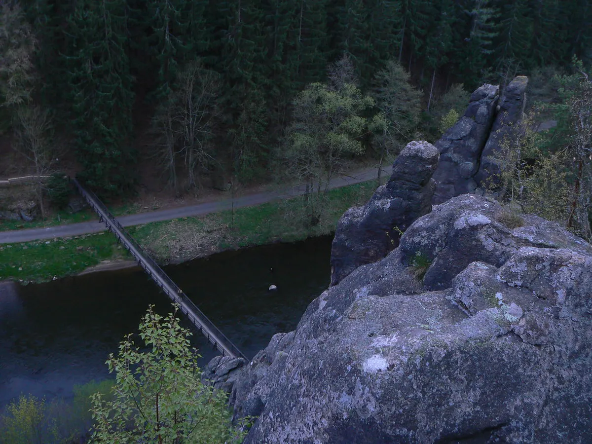
The total length of the walk from the edge of Karlovy Vary to the rocks is about 10 kilometers. This distance covers the round trip if you start from the Doubí neighborhood. Most walkers complete the journey in about 2 to 3 hours. The path is almost entirely flat as it follows the Ohře River valley.
The elevation gain is minimal, making it an easy-rated trail. You will not face any steep scrambles or dangerous ledges. In 2026, the path remains well-maintained and clearly marked with tourist signs. It is a perfect choice for a half-day excursion without needing heavy gear.
Many visitors choose to do the Svatoš Rocks nature hike as a point-to-point walk. You can walk to the rocks and then continue toward the village of Loket. This extends the trip but keeps the difficulty level low. The terrain consists of paved sections and hard-packed gravel.
Breaking Down the Trail Difficulty and Terrain
The Svatošské skály hiking trail difficulty and length are ideal for all ages. The path is wide enough for groups to walk side-by-side. Because the surface is mostly smooth, it is accessible for robust strollers. However, some sections have small stones that might be bumpy for thin wheels.
Cyclists frequently use this route as part of the Wallenstein cycle path. If you are walking, stay to the side to allow bikes to pass safely. The lack of steep hills means you do not need high levels of fitness. It feels more like a long park stroll than a rugged wilderness trek.
During the winter or after heavy rain, the unpaved sections can get muddy. We recommend wearing comfortable sneakers or light hiking shoes. You do not need professional mountain boots for this specific route. The ease of the terrain allows you to focus on the surrounding granite towers.
The Svatošské Skály Experience: Pros and Cons
The main highlight of this trail is the group of granite pillars known as the "Wedding Procession." These massive rocks rise dramatically from the forest floor. Legend says they are a petrified wedding party turned to stone by a water sprite. The visual impact is impressive and provides great photo opportunities.
- Pros: Very easy navigation, beautiful river views, and family-friendly atmosphere.
- Cons: Can get crowded on weekends, limited shade in some spots, and shared with many cyclists.
Crowds are the biggest drawback during the peak summer season in 2026. If you prefer solitude, try to start your walk before 9:00 AM. On weekdays, the trail is significantly quieter and more peaceful. There are several spots along the river to sit and enjoy a picnic.
Practical Tips for Your Svatoš Rocks Nature Hike
To begin your journey, you can take a local bus from the city center. Check the schedules at the Dopravní podnik Karlovy Vary website for the best routes. Most hikers start at the Doubí bus stop and follow the blue or green markers. You can also find more details on how to get to Svatoš Rocks from Karlovy Vary online.
There is a small restaurant and a seasonal snack bar near the rocks. These are great for a quick refreshment or a traditional Czech meal. However, they can be very busy during lunch hours. Bringing your own water is always a smart move, especially on hot days.
For the best experience, visit the Karlovy Vary Official Tourism site to check for local events. Sometimes the valley hosts small festivals or guided tours. The trail is open year-round, but autumn offers the most beautiful foliage. Spring is also lovely when the river is high and the greenery is fresh.
Frequently Asked Questions
How long is the Svatošské skály hiking trail?
The trail is approximately 10 kilometers long for a round trip from the Doubí district. If you continue to Loket, the total distance is about 12 kilometers. Most walkers spend 3 hours on the trail.
Is the Svatoš Rocks trail difficult for seniors?
No, the trail is considered easy and is very popular with seniors. The path is mostly flat with no significant climbing. The well-maintained surface makes it a safe choice for those with moderate mobility.
Can I bike to Svatošské skály?
Yes, the trail is part of a major cycling route. It is well-suited for mountain bikes and trekking bikes. Just be mindful of pedestrians, as the path is shared throughout the valley.
The Svatošské skály hiking trail difficulty and length make it a top-tier choice for a relaxing day out. It combines local folklore, stunning geology, and an easy-to-follow path. Whether you are walking or cycling, the valley offers a refreshing break from the colonnades. Plan your visit for a weekday morning to enjoy the best of this natural wonder in 2026.
Official resources
Use these sources for official schedules, tickets, routes, and updates.
- Karlovy Vary Official Tourism — unverified: Official DMO site.
- Statutory City of Karlovy Vary — unverified: Official municipal portal.
- Visit Czechia — unverified: National tourism board.
- UNESCO World Heritage Centre — unverified: Official UNESCO listing for the city.
- Lonely Planet Karlovy Vary — unverified: Tier 3 editorial requirement.