How to Hike from Holubov to Dívčí Kámen Ruins Map Included
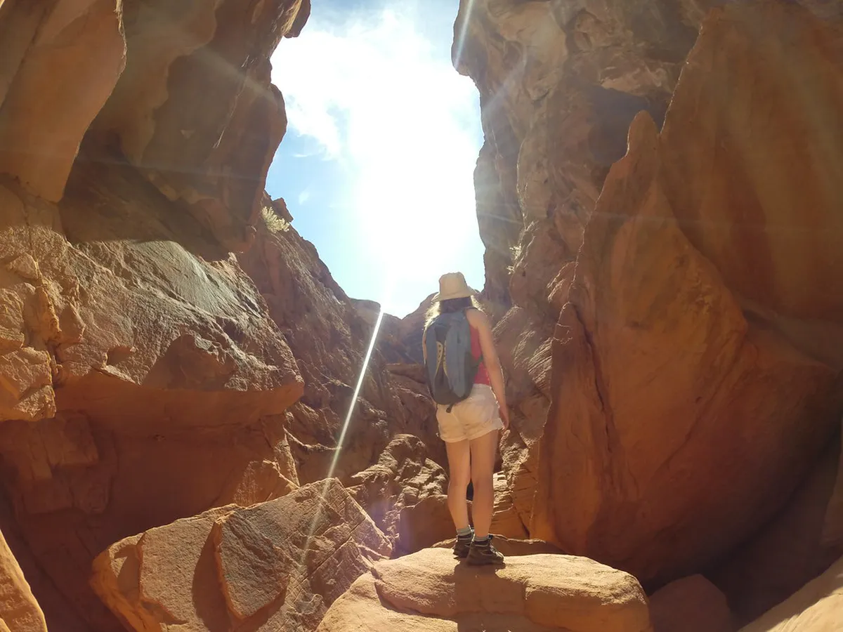
The best way to reach these ruins is the 3-kilometer yellow trail from Holubov station. This path is flat, shaded, and perfect for families or casual walkers. You can also start from the nearby Třísov station for a shorter but steeper climb. Using a hike from Holubov to Dívčí Kámen ruins map will ensure you stay on the correct path through the Blanský les forest. This area is one of the best day trips from Cesky Krumlov for nature lovers. Most visitors spend about three to four hours for the total round trip.
Planning Your Hike from Holubov to Dívčí Kámen Ruins Map
The trail from Holubov to the ruins is part of a protected landscape area. It follows the Křemžský stream through a deep, green valley. Most hikers find this route easier than the alternative path from Třísov. You should plan for a total walking distance of about 7 kilometers if you do a loop. The terrain is mostly gravel or packed dirt. It is suitable for sturdy strollers but can be muddy after rain.
Before you leave, check the train to Divci Kamen from Cesky Krumlov schedule to time your return. Trains usually run every one to two hours. If you have extra time, you can extend your journey. Some travelers combine this with visiting Ceske Budejovice from Krumlov as they are on the same rail line. Always carry a digital or paper hike from Holubov to Dívčí Kámen ruins map.
If you prefer a direct route, follow the yellow trail markers from the station. If you want a more challenging day, you can hike up to the Kleť mountain lookout first. However, for a relaxing afternoon, the riverside walk is superior. The ruins are open year-round, but the best light for photos is in the late afternoon. Ensure you have enough daylight to return to the station safely.
Essential Checklist for Your South Bohemia Adventure
Preparation is key for a smooth experience in the Czech countryside. While the trail is well-marked, local knowledge helps avoid small frustrations. You will need specific items to enjoy the Divci Kamen castle ruins hike to the fullest. Here is what you should prepare before leaving your hotel.
- Mapy.cz App: Download the offline map for South Bohemia. It is more accurate than Google Maps for Czech forest trails.
- Cash (CZK): Bring at least 200 CZK in small coins or bills. The entry gate often uses a self-service payment box.
- Water and Snacks: There are limited shops in Holubov. Carry at least one liter of water per person.
- Comfortable Shoes: Sneakers are fine, but hiking boots provide better grip on the castle's rocky sections.
- Power Bank: GPS usage drains battery quickly in areas with weak cellular signals.
Step-by-Step Guide to the Holubov Trail
This guide walks you through the most popular route. It starts at the train station and ends at the ruins. Follow these steps for a stress-free hike from Holubov to Dívčí Kámen ruins map adventure.
- Step 1: Arrive at Holubov Station. Take the local train from Český Krumlov. The ride takes about 15 minutes. Time: 5 minutes to exit. Typical Cost: 40 CZK. Where: Holubov train platform. Common Mistake: Forgetting to validate your paper ticket on the platform or inside the train.
- Step 2: Follow the Yellow Markers. Look for the yellow and white striped signs on trees and poles. The path leads past a local sawmill and into the forest. Time: 45 minutes. Typical Cost: Free. Where: Forest trail along the stream. Common Mistake: Turning onto the blue trail by mistake near the start of the woods.
- Step 3: Enter the Castle Ruins. Cross the wooden bridge over the Vltava river. Pay the entry fee at the gate or the small kiosk if it is open. Time: 60 minutes for exploring. Typical Cost: 100 CZK. Where: Main castle gate. Common Mistake: Arriving without cash coins for the automated entry turnstile.
- Step 4: Return via Třísov. Follow the red trail markers uphill from the castle to reach Třísov station. This creates a scenic loop rather than doubling back. Time: 30 minutes. Typical Cost: Free. Where: Uphill red path. Common Mistake: Missing the train back because you didn't check the Třísov station departure board.
For official information on the region, you can visit the Český Krumlov Official Tourism portal. They provide updates on local events and trail conditions. If you need more travel inspiration, the Visit Czechia site offers great overviews of the South Bohemia region.
Troubleshooting Common Hike Issues
Even the best-planned trips can face minor hurdles. Knowing how to handle them will keep your day enjoyable. Here are the most frequent issues hikers encounter on the way to Dívčí Kámen.
- Lost Trail Markers: If you haven't seen a yellow stripe for 200 meters, turn back. You likely missed a turn at a junction.
- Dead Phone Battery: The valley has spots with no signal. Always look for the physical signs on trees as a backup.
- Closed Kiosk: The refreshment stand at the ruins is often closed on weekdays. Always bring your own food.
- Slippery Rocks: The ruins can be dangerous in the rain. Stay on the designated paths and avoid climbing loose walls.
- Train Delays: Czech trains are usually on time, but track work can happen. Check the IDOS app for real-time updates.
- No Change for Entry: If the payment box is full or you lack coins, look for the QR code payment option if available.
Best Times to Visit and Costs for 2026
In 2026, prices for local transport and entry are expected to rise slightly. Budget around 300 CZK per person for the entire day trip. This covers your train tickets, castle entry, and a light snack. May and September offer the best weather for hiking. The temperatures are mild, and the forest colors are vibrant.
Summer is the busiest season, especially on weekends. If you visit in July, try to arrive at Holubov before 10:00 AM. This helps you avoid the largest crowds and the midday heat. Winter visits are possible and very peaceful. However, the trail can be icy, and the castle ruins may have limited access during heavy snow.
Always check the local weather forecast before departing. South Bohemia can experience sudden thunderstorms in the late afternoon. A light raincoat is a smart addition to your bag. By following this hike from Holubov to Dívčí Kámen ruins map guide, you are ready for a memorable day.
Frequently Asked Questions
How long does it take to hike from Holubov to Dívčí Kámen?
The hike from Holubov to Dívčí Kámen typically takes about 45 to 60 minutes one way. The path is roughly 3 kilometers long. Most travelers spend an additional hour exploring the castle ruins before walking back or continuing to Třísov station.
Is the trail to Dívčí Kámen suitable for children?
Yes, the yellow trail from Holubov is very family-friendly. It is mostly flat and follows a scenic stream. Children enjoy exploring the large castle ruins. However, parents should keep a close eye on kids near the steep drops within the castle walls.
Do I need to book tickets for Dívčí Kámen in advance?
No, you do not need to book tickets in advance. There is a self-service payment system at the entrance that accepts cash and sometimes cards. It is open 24/7, allowing you to visit at any time of the day.
Hiking from Holubov to the Dívčí Kámen ruins is a highlight of any South Bohemia itinerary. The trail offers a perfect mix of nature, history, and easy exercise. Remember to bring cash for the entry fee and download your maps for offline use. After your hike, you might want to explore more of the region. Check out our guide on a day trip to Hluboka Castle for another stunning South Bohemian landmark. Enjoy your adventure in the Czech countryside!
Official resources
Use these sources for official schedules, tickets, routes, and updates.
- Český Krumlov Official Tourism — Official DMO portal. (unverified)
- Visit Czechia — National tourism board. (unverified)
- UNESCO World Heritage Centre — Official UNESCO listing. (unverified)
- Lonely Planet — Major editorial travel guide. (unverified)
- State Castle and Chateau Český Krumlov — Official landmark site. (unverified)
- Egon Schiele Art Centrum — Major city museum. (unverified)